
A deep depression over the Bay of Bengal has brought heavy rainfall to parts of Andhra Pradesh and Odisha, leading to the evacuation of at least 3,500 people and prompting authorities to issue red and orange alerts for several districts.


Heavy rains across Tamil Nadu have caused localised waterlogging and brought down temperatures, particularly in districts like Madurai and Virudhunagar. A tragic incident in Virudhunagar district saw a 17-year-old girl die and her mother injured after a house wall collapsed due to the downpour. Meanwhile, the India Meteorological Department has forecast the formation of a cyclonic storm in the Bay of Bengal by October 26, which is expected to move towards North Andhra Pradesh and South Odisha coasts, though it poses no direct threat to Tamil Nadu.
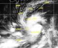
A deep depression over the Bay of Bengal crossed the coast near Nagapattinam on Saturday afternoon.
Depression over Bay of Bengal intensifies

It said the weather system was expected to intensify into a deep depression by 5.30 am on Wednesday and turn into Cyclone Mocha in the next 12 hours, packing wind speeds of 80-90 kmph and gusting to 100 kmph.

A well-marked low-pressure area over southwest Bay of Bengal intensified into a depression on Thursday morning packing wind speed of 40-50 kmph as it moved towards the north Tamil Nadu coast, the weather office said.

The Odisha government has put all 30 districts on alert as a depression over the Bay of Bengal intensified into a deep depression and is moving towards the east coast. The IMD forecasts very heavy to extremely heavy rainfall in Odisha on October 28 and 29.
Cyclonic storm Baaz weakens over Bay of Bengal.

More than 150 express/passenger trains running through South Eastern Railway jurisdiction have been cancelled in view of the severe cyclonic storm, an SER official said.
The strong wind that is expected may cause damage to thatched houses, uproot trees and disrupt power supply and communication network in coastal Orissa and neighbouring AP.

As the Northeast monsoon intensified across Tamil Nadu, the regional weather office issued heavy rainfall alert to a number of districts. Chief Minister M K Stalin reviewed the situation and directed precautionary measures.

The Odisha government has asked all the district collectors to remain prepared for any eventuality, and directed the administration to evacuate people from low-lying areas in the event of heavy rain.

Heavy rains continue to batter Tamil Nadu, causing a rise in reservoir levels and prompting a red alert. Schools and colleges are closed in several districts as authorities prepare for potential flooding.

'There will not be very heavy rain.' 'Moderate showers will be there and winds will be, say, somewhere between 20 and 40 km/hr, gusting to 35 km/hr.'

The weather system remained practically stationary during the last six hours and weakened to a depression, and is likely to turn into a well-marked low pressure area during the next 12 hours, it said in a bulletin.
It was likely to move in a west-north-westerly direction and weaken gradually, triggering heavy rains in interior parts of the state.

The deep depression over central Bay of Bengal is likely to intensify into a cyclonic storm by Sunday evening and after changing course in a northeastward direction from northwest.
Squally weather with wind speed reaching 55-65 kmph was likely to prevail along and off the Orissa coast, the sources said.

The Andhra Pradesh government has prepared an action plan for relief and essential supplies in pre-cyclone preparedness for Cyclone Montha, expected to cross the coast on October 28.

The system lay centered at 5.30 am over Southeast Bay of Bengal, about 450 km west-northwest of Car Nicobar (Nicobar Islands), 380 km west of Port Blair (Andaman Islands), 970 km southeast of Visakhapatnam (Andhra Pradesh) and 1030 km south-southeast of Puri (Odisha).
As Odisha and West Bengal are bracing for a severe cyclonic storm, governments of both states started evacuating people and while deciding to close educational institutions in vulnerable areas.
West Bengal: Flood situation improves, alert still on

A deep depression over the Bay of Bengal intensified into a cyclonic storm, named Remal, on Saturday evening and is likely to turn severe before making landfall between the coasts of West Bengal and Bangladesh on Sunday midnight, the India Meteorological Department (IMD) said.

The cyclonic storm is likely to move nearly westwards and cross north Andhra Pradesh-south Odisha coasts between Kalingapatnam and Gopalpur around Sunday evening, the Cyclone Warning Division of the IMD said.

The IMD has issued a red-colour coded warning for the southern areas of Tamil Nadu Kerala in view of the brewing storm and said that these areas are expected to receive heavy to very heavy rainfall.

As per the India Meteorological Department (IMD), which closely monitors the cyclonic storm said, 'The SCS 'Mocha' intensified into a very severe cyclonic storm, lay centred at 05.30 hours IST of 12th May 2023 over central adjoining southeast Bay of Bengal near latitude 13.2N and long 88.1E, about 520 km west-northwest of Port Blair.'

The depression over southeast Bay of Bengal in Andaman and Nicobar Islands developed into a deep depression and intensified into a cyclonic storm "Vardah."

India recorded around 16 per cent more rainfall than normal in August, with rainfall over Northwest India recorded at 253.9 mm, the second highest in August since 2001, the India Meteorological Department (IMD) said on Saturday.

The situation in fact is not that worrying for Thursday and IMD regional director Ganesh Das said the rain is expected to be "light and moderate".

The met department said rainfall is very likely at most places in Tamil Nadu, Puduchery and Karaikal with heavy to very heavy showers at a few places and extremely heavy rainfall at isolated places on Wednesday.

The MeT department warned of heavy to very heavy rainfall in Gangetic West Bengal till Saturday, ahead of Durga Puja festivities.
The weather system moved west-northwestward and concentrated into a depression on Saturday at 8.30am, close to west of Andaman Islands, the bulletin said.

The depression, which was initially over west-central Bay of Bengal and adjoining areas, moved westward and intensified into a deep depression.
The IMD has warned of squally winds speed reaching 45-55 kmph gusting to 65 kmph likely to commence along and off Odisha and north coastal Andhra Pradesh coasts from October 27 onwards.
Odisha is bracing for heavy rainfall early next week under the impact of a possible cyclone in the Bay of Bengal, which is likely to skirt the state and move towards West Bengal and Bangladesh, the Indian Meteorological Department (IMD) said on Friday.

Life in Kolkata came to a standstill even before Cyclone Aila hit on Monday, killing 17, including a woman, and injuring many. High-velocity winds and heavy rains lashed the coastal areas of the state from Monday morning. All flights, including international ones, at the NSC Bose International Airport were suspended from 1400 hours, airport sources said.

The deep depression which had formed over the south west of Bay of Bengal has intensified into a cyclone named Nelam, which is expected to cross over Nagapattinam and Nellore (South Andhra Pradesh) on Wednesday evening,

The meteorological department said that a deep depression in the Bay of Bengal was developing into a marginal cyclone and was set to hit the northern coast of Sri Lanka.
